• English
    • Italiano (Italian)
English
Mon - Sat 10.00 - 19.00. Sunday CLOSED
Logo Dron-e
DJI ENTERPRISE
DEALER & CONSULTING
+39 0961770591
Call Us Directly
Viale V. De Filippis, 58
88100 Catanzaro - Italy
  • Home
  • About us
    • Our approach
  • Services
    • Aerial Lidar
    • Photogrammetry
    • Inspection
    • Thermography
    • Confined Spaces
    • Specialized Consulting
    • Aerial Cinematography
    • Training center
    • Emesent Dealer
    • DJI Enterprise Dealer
  • Cases
  • News
  • Pilots
    • Drone Pilot Training
    • Drone Pilot Network
  • Contact us
  • Product
    • DJI Enterprise
      • Matrice Series
      • Mavic Series
      • Phantom Series
      • Dock Series
      • Accessories
    • Gimbal e Sensor
      • LiDar
      • Cameras
      • Emesent Hovermap
      • GPR
      • Magnetometers
      • Sampling
    • Software
      • Agisoft Metashape
      • DJI Software
      • Pix4D
      • Terrasolid
      • PointCab
    • Safety systems
      • Parachutes
    • Topography
      • Emlid
  • Assistenza tecnica
0
No products in the cart.
Site Logo
HomeWorksOil & Gas
  • Digitization of the “Monte Alpi – Taranto” oil pipeline

    • May 25, 2021
    • Posted by: noAdmin
    • Categories:
    No Comments

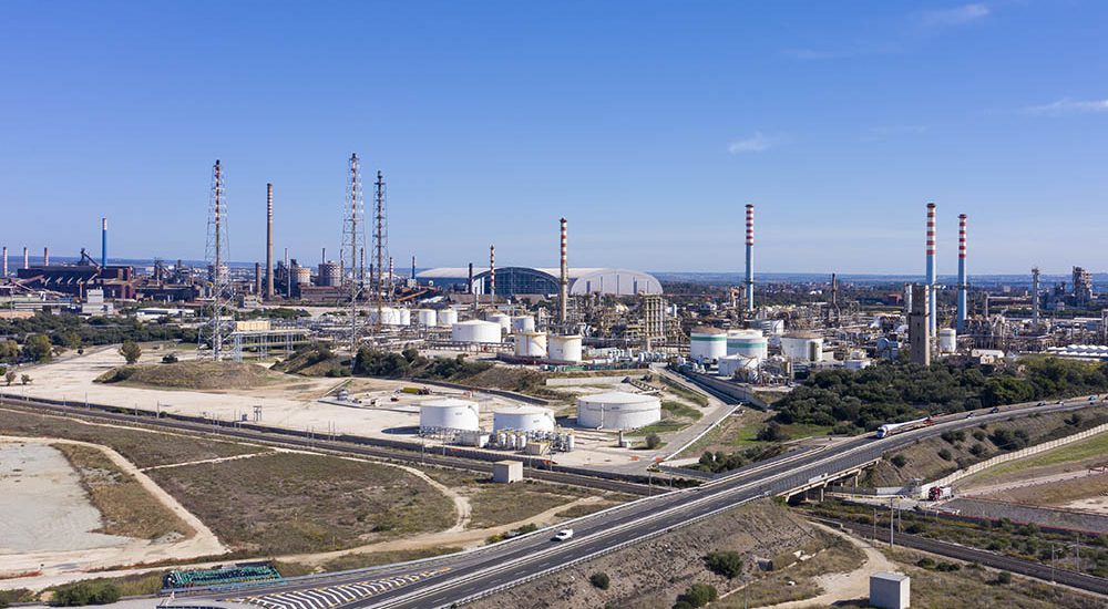
    Trans-adriatic pipeline inspection

    read more
categories
  • DJI Enterprise Dealer
  • Innovation
  • LiDar Survey
  • News
  • News
  • Photogrammetry
  • Press Release
  • Survey & Mapping
  • Webinar

how can we help you?

Contact us at the Dron-e office or submit a business inquiry online.

contacts
archive
tags
3d aerial photogrammetry Aerodyne group agisoft Agricoltura di precisione Agriculture agriculture drone system autonomous flight BIM bridge camera multispettrale confined spaces digital twin DJI Agriculture DJI Dealer DJI Enterprise DJI M30T DJI Matrice 300 RTK DJI Mavic 3 Enterprise DJI Zenmuse H20N dron-e Drone RTK droni autonomi Droni in agricoltura Emesent infrastructure inspection laser scanner level of autonomy LiDAR Mavic 3 Multispectral metashape NDVI Phantom 4 multispectral photogrammetry pilota di droni power grid reconstruction road tunnel slam software spraying drones Thermal Analysis Thermal Drones volo autonomo

Aerial Survey & Mapping

Your UAS System Integrator, use drones to solve – almost – all your problems.

Dron-e is an Italian Drone Solution & Services Provider founded in 2014.

ENAC.UAS-RE.094

Recent news

  • Agisoft Metashape – Version 2.2 updates January 13, 2025
  • Emesent presents Backpack RTK for Hovermap: new possibilities for even more accurate SLAM surveys September 20, 2024
  • Come diventare pilota di drone professionale February 28, 2023

Extra links

  • Services
  • Shop
  • Cases
  • Drone Pilot Training
  • News
  • Drone Pilot Network
  • Assistenza tecnica
  • Contact us

EASA Recognised Entities-RE according to Regulation (EU) 2019/947

DJI Enterprise Authorized Dealer

Agisoft Metashape Official Reseller & Training Center

©2024 Copyright Dron-e All Rights Reserved. - Termini e condizioni - Privacy | easy city srls - VAT. IT03366240798