- January 13, 2025
- Posted by: noAdmin
- Categories: News, Photogrammetry, Press Release
A big step in LiDAR and photogrammetric data processing
Agisoft Metashape quickly became one of the most diffused software when it comes to photogrammetric data processing, offering advanced solutions for 3D models and orthomosaic generation. Last year, version 2.0 included tools dedicated to to LiDAR and TLS data management, further enhancing and expanding them in version 2.2, offering better flexibility and quality control procedures.
Here are some of the new features of version 2.2.0:
Advanced LiDAR processing
- Boresight Calibration
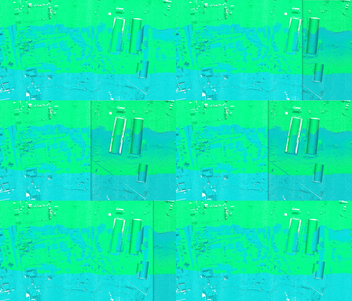
It is now possible to perform boresight calibration for aerial LiDARs. This process allows for better alignment between aerial LiDAR scans - Accuracy view for LiDAR point clouds comparison
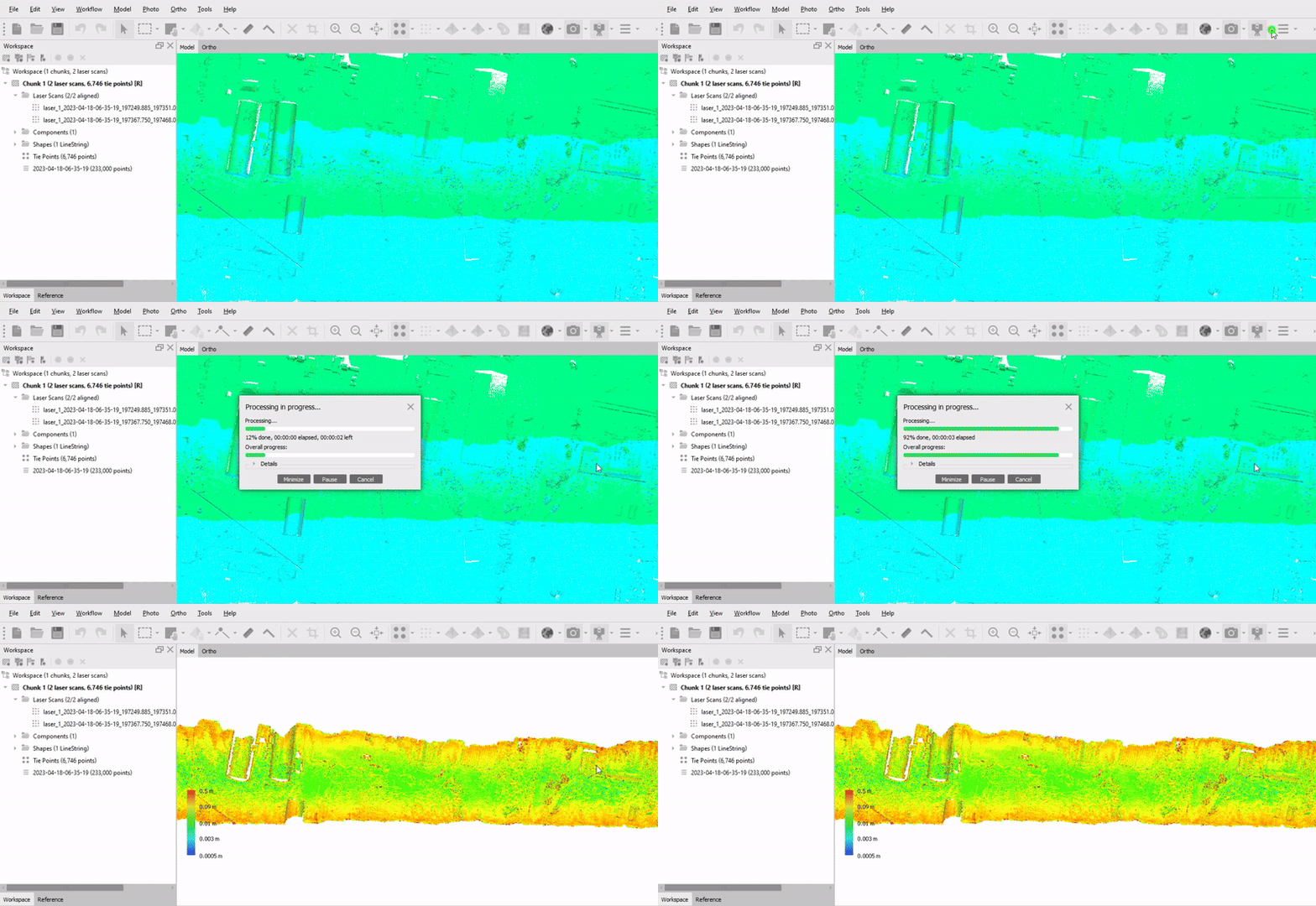
To evaluate the accuracy of the alignment of LiDAR data sets, the Difference View tool has been added. Tool displays the area of overlap of LiDAR point clouds and query the points according to the error value. - Measure point cloud accuracy using check point coordinates
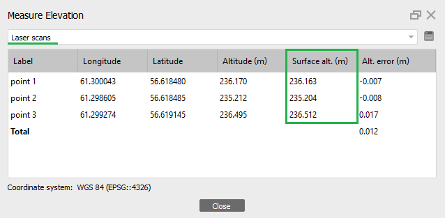
The new tool helps to estimate the altitude error for control and check points. The dialog box will display the altitude values for the original marker (imported into the project) and the altitude values on the surface.
The Surface alt. (m) column displays the altitude value for the marker on the selected surface, in our example, on the surface of a laser scan.
Orthomosaic and texture generation improvement
Version 2.2 can create higher quality orthomosaic, improving the final results.
- Build texture from orthomosaic
Starting from version 2.2, it is possible to build textures using orthomosaic rather than the original images. - Splitting the mesh model into blocks
If you have already built a mesh model, then you can divide it into blocks by building a block model based on the mesh model. - Build orthomosaic from textured model
It is also possible to build an orthomosaic from a textured model or a tiled model. In this case it is important to select the Model (or a Tiled Model) as the Source data and to enable the Transfer model texture option. - An experimental feature to improve the area near the edges of the roof
In version 2.2, the test algorithm has been developed that can help improve areas near the edges of roofs (“wavy” effect, white areas, and so on). The algorithm has been added in test mode and is available by tweak – main/enable_refine_roof_edges = True. This is especially helpful urban areas. - Pansharpening
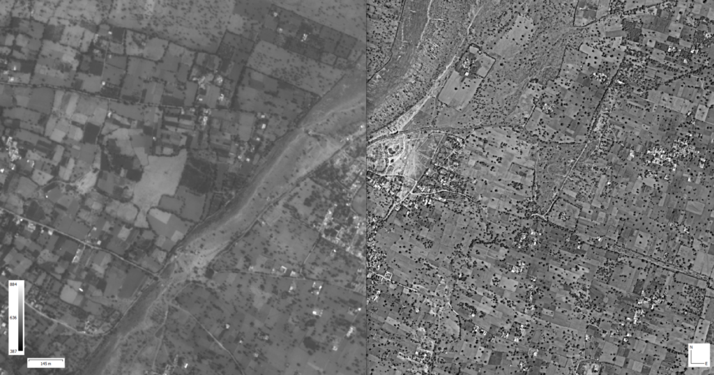
Starting from Agisoft Metashape 2.2, it is possible to improve the quality of orthomosaic based on higher resolution data, like using the panchromatic camera from an Altum PT or RedEdge P to enhance the single bands.
New functions for data processing and management
- AprilTags coded targets
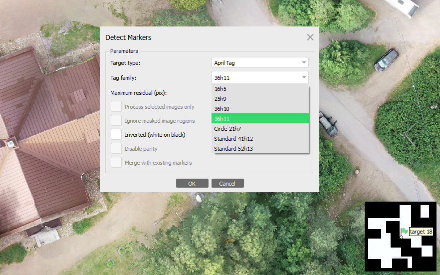
In Agisoft Metashape 2.2, it is possible to automatically detect AprilTags.
- Align cameras by reference
Tool allows you to make unaligned images aligned according to the loaded reference. It is important that the cameras have the values of coordinates and angles, then the tool will work.This method is useful when there is a water surface with not aligned cameras corresponding to it. Aligning such images by the reference will help to fill the holes during the orthomosaic generation. That is, these images will only be used for building orthomosaic or texturing. But it is important to have the existing surface for the corresponding areas, i.e. if you use DEM as the surface, then the area corresponding to the not aligned cameras can be filled using either DEM editing tool or use Interpolation – Extrapolated when building a DEM.
Optimization and user experience improvements
- Automatic (AI) background masking
AI can be used to generate masks for the background. - Multiple masks instances support
It is now possible to store several mask sets in different layers and choose whether to use masks during building depth maps, orthomosaic, texture or not. - Saving geoid files in a project
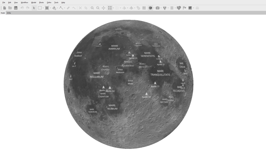
It is possible to save the geoid file that was used in the project. - Supporto di sistemi di riferimento non terrestri
Una novità che amplia l’applicabilità del software a scenari con sistemi di riferimento personalizzati.
- Intermediate saving
The reconstruction algorithms include subtasks during processing. If there is a problem during processing related to the unexpected Metashape termination (crash, shut down, etc) now it is possible to continue the processing operation from the moment when the problem occurred. That is, after the problem occurred when reopening the project, processing will automatically continue from the previous saved task on which the failure occurred.In order for this algorithm to be available, it is important that the processing of each stage is saved.
Free upgrade from previous versions.
Il nuovo rilascio ha inoltre adottato un nuovo sistema di licensing per la versione Professional a causa del quale verrà nuovamente richiesto il product-key a momento dell’aggiornamento. L’aggiornamento da PhotoScan/Metashape 1.x a Metashape 2.x è completamente gratuito e non richiede alcun pagamento aggiuntivo da parte degli utenti con licenza.
Puoi scaricare la nuova versione da qui: download Agisoft Metashape.
Buy a license and training course with us.
Dron-e è un centro di formazione autorizzato e rivenditore ufficiale Agisoft Metashape, puoi vedere le licenze disponibili qui: licenze Agisoft Metashape. Stay connected – Civil & Industrial Applications with UAVs.

