As Built reconstruction – Terna S.p.A.
Having up-to-date 3D models and drawings of critical assets is the top priority in infrastructures like the ones involved in power distribution/delivery, however updating the existing documentation can often be a risky and time-consuming operation.
Thanks to the advance il LiDAR technologies, it is now possible to map complex structures like trellis in matter of minutes, being then able to report every kind of measurement on CAD files from the office, limiting the need to shutdown the line in order to climb and measure just to the most complex components.
Sometimes the initial drawing get lost after long time periods or does not match the actual construction, as there has been some changes made on-the-fly in order to adapt to an unexpected situation.
Those discrepancy can cause a lot of problems when dealing with upgrade/replacement projects for various reasons:
- Stability:
Did the metal structure get bent during the years, due to accidents or extreme weather conditions? Will it be able to withstand a new component?
- Inteference:
Did the metal structure get bent during the years, due to accidents or extreme weather conditions? Will it be able to withstand a new component?
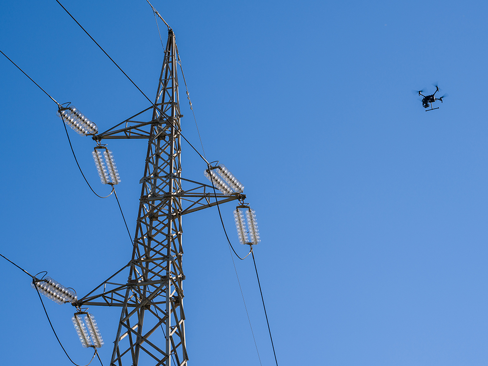
In order to get detailed data it is mandatory to fly as close as possible to the various elements.
Flying very close to a powered 380kV tower will present different kinds of difficulties:
- Electro-magnetic interference:
High-Voltage lines will generate lots of interference that can render most drones uncontrollable.
- Obstacles:
Complex structures have many protuding components that will be hard to avoid for most pilots, also it will be necessary to be able to pilot in direct proximity to trees and vegetation.
- Mapping:
Every single detail of the asset must be inspected.
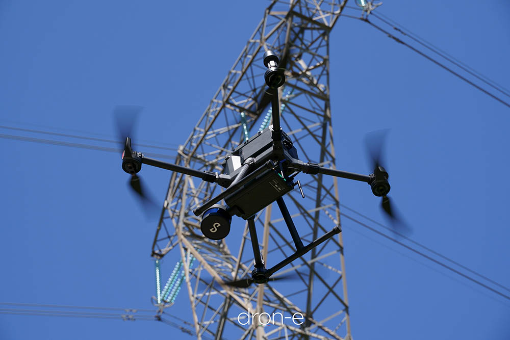
Thanks to a rigorous training and our advanced equipment, our pilot are able to fly in the most dangerous enviroments with ease.
Our drones are equipped with RTK technologies, that are immune to magnetic interference, and they are also able to fly with no GPS coverage thanks to state of the art SLAM-LiDAR navigation technologies.
A standardized flight planning procedure allow us to capture even the smallest details with the highest accuracy possible.
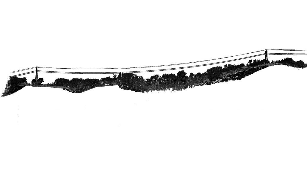
In a matter of hours, we were able to deliver an accurate point cloud of the entire length of line inspected, giving the technicians the possibility to check for any kind of problem like proximity to building or trees.
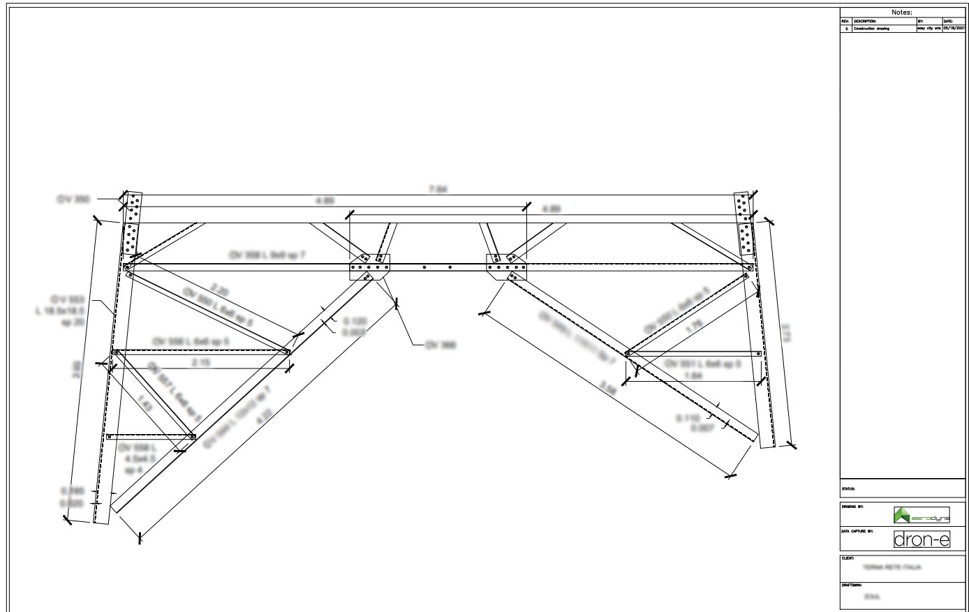
During the upcoming days, the close-up data has been processed and transferred to CAD drawings that aided the design of new components for the tower.