PiX4Dmapper is the ideal photogrammetry software for your drone mapping activity.
With this software you will be able to take advantage of various features, which will allow you to obtain precise and reliable results.
• Capture
Take your own thermal, multispectral and drone-captured images.
• Digitize
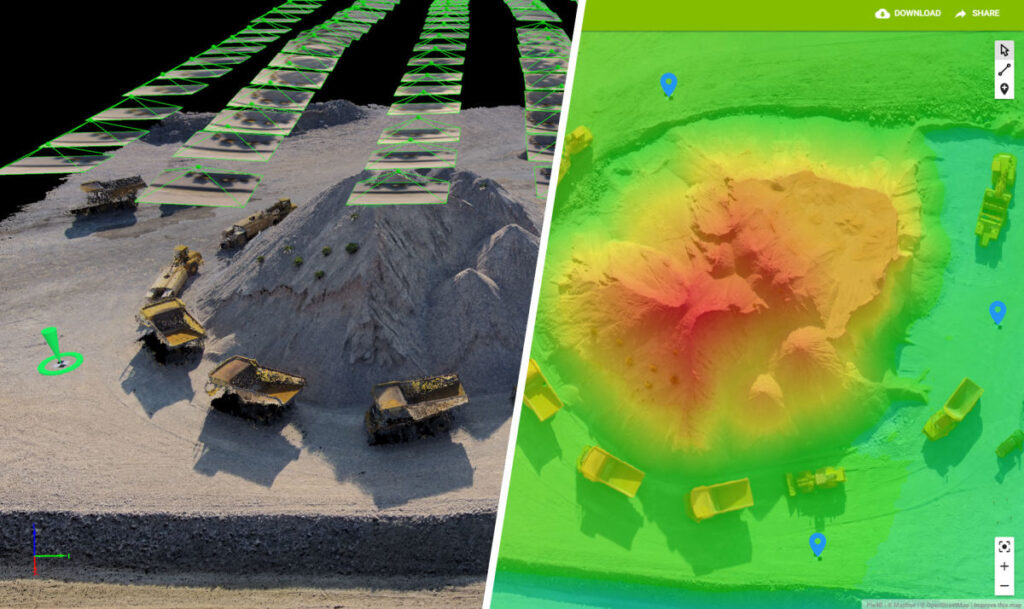
With Pix4Dmapper you can transform these images into digital spatial models then process your projects both in the cloud and with the desktop photogrammetry platform.
• Check it out
You can improve and evaluate the quality of your product, to have a preview of the generated results, calibration details and many other indicators of project quality.
• Measure and inspect
You have tools to measure distances, areas and volumes, which allow you to perform virtual inspections.
• Collaborate and share
Simplify teamwork and securely share project data with both your team and your clients.
File formats can be standard or online with Pix4D Cloud, based on your preferences.