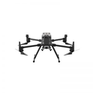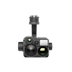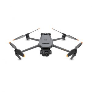

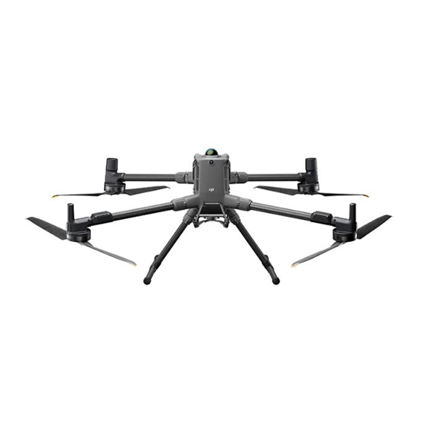
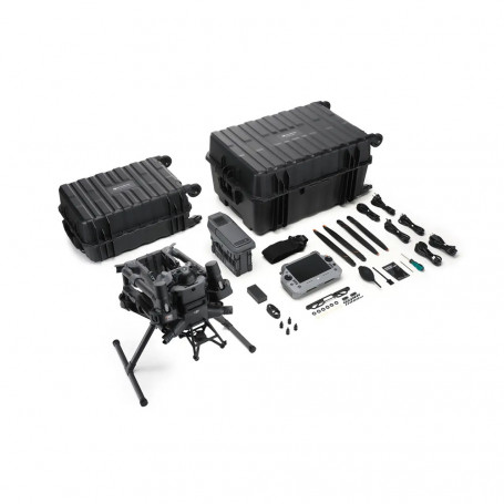
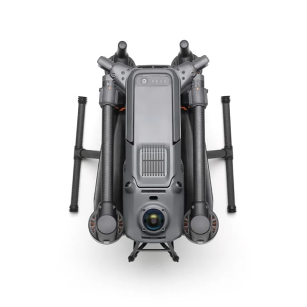
The DJI Matrice 400 is a long-endurance enterprise drone designed for inspections, emergency response, mapping, and AEC applications. It offers a flight time of 59 minutes, supports payloads of up to 6 kg and can carry up to 7 kg, and includes a rotating LiDAR and mmWave radar for precise obstacle detection. The M400 is also compatible with the O4 Enterprise and Airborne Relay video transmission systems.
Intelligent Flight Battery and Charging Station sold separately.
A new industry standard
Carry up to 7 payloads with the DJI Matrice 400
Endurance and Speed: Fly up to 59 minutes with payloads and reach speeds up to 25 m/s.
Payload Flexibility: Carry up to 6kg and mount 7 payloads via 4 E-Port V2 interfaces.
Integrated rotating LiDAR and mmWave radar: Enables precise obstacle detection at power line level, improving safety and operational accuracy.
Reliable Transmission: Transmits video up to 20km (CE/SRRC/MIC).
Rugged Design: Operate safely in harsh conditions with IP55 protection and color visual detection.
Intelligent Detection: Combines visible and thermal imagery for greater situational awareness.
AR Projection: View key data like lines, maps and routes in real time for better decision making.
Terrain-Aware Flight: Maintain altitude with real-time terrain tracking for safer, smoother operations.
Advanced Flight Automation: Use Cruise, FlyTo, Smart Track and POI modes for simplified missions.
Marine-ready: Takes off and lands from vessels for flexible deployment in offshore environments.
Specialized Routes: Follow slopes, geometry, and power lines for efficient, automated data collection.
Next-Generation Power: All-new intelligent charging station improves charging and mission readiness.
On-board processing: The Manifold 3* computer offers 100 TOPS of processing power for AI-driven tasks.
*Sold separately
Robust flight performance
Maintain long battery life, high speed and reliable transmission in harsh environments.
Longer Flights: Get up to 59 minutes of forward flight or 53 minutes of hover with the Zenmuse H30T payload, a 50% improvement over the M350.
High-speed performance: Achieve a maximum flight speed of 25 m/s and a heading speed 60% faster than the M350 for faster mission completion.
Vertical agility: ascend at up to 10 m/s and descend at 8 m/s to quickly adapt to changing terrain and conditions.
All-Weather Resistance: IP55 certified to operate from -20°C to 50°C in heavy rain, dust and fog.
Reliable Video Transmission: The O4 Enterprise system supports stable video links up to 20km under CE/SRRC/MIC conditions, ensuring consistent performance during extended missions (40km FCC).
Dual 4G Connectivity: Compatible with two DJI Cellular Dongle 2 modules, enabling automatic network switching for improved signal stability in urban or remote areas.
Extended Frequency Support: Operates on sub-2G bands for greater signal penetration and reliability in complex or congested environments.
Advanced Antenna Design: Equipped with a ten-antenna array on the aircraft and a high-gain phased array antenna on the remote controller to maximize transmission quality.
Integrated Relay Module: One Matrice 400 can act as a high-altitude relay drone, extending communications to another unit operating remotely.
Air Relay Capability: Supports air relay video transmission, maintaining stable connectivity even in mountainous or obstacle terrain. Compatibility for using the Matrice 4D as a relay drone will be available soon.
High payload capacity with versatile compatibility
Supports up to 7 payloads with a weight limit of 6kg
Flexible Payload Integration: Carry up to 6kg using the third gimbal connector.
Supports up to 7 payloads simultaneously via 4 E-Port V2 interfaces.
Versatile Gimbal Options: Configurable with single, dual, or third-down gimbal connectors for extended mission configurations.
Compatible with Manifold 3, on-board computer with 100 TOPS of processing power, for advanced processing capabilities.
Compatible with Zenmuse S1 Spotlight and V1 Speaker for specialized tasks like search and rescue.
Open data interfaces for drone payloads, LiDAR and mmWave Rad.
Impact of payload on flight time: 59 min with P1 / L2 / H30T individually. 53 min with H30T and V1 (1 kg). 50 min with H30T and S1 (1.5 kg). 44 min with 3 kg of payload. 31 min flight with 6 kg of payload.
Power Line Inspection: When paired with the Zenmuse L2, the system automatically recognizes power line corridors and branch paths. Operators can select a specific line and the drone will autonomously follow it based on preset parameters. A real-time 3D point cloud of the corridor is displayed on the remote controller for real-time situational awareness.
Safe and reliable sensor system
An advanced multi-sensor system provides precise obstacle detection at power line level, even in low light, rain or fog.
Powerline Obstacle Detection: Detects large and small obstacles, including wires, for safer flights in complex environments.
Powerline-level obstacle detection: Uses LiDAR and millimeter-wave radar for improved obstacle detection.
All-Weather Situational Awareness: Maintains detection performance in low-light, rain and fog for reliable year-round operations.
Fusion Positioning: Combines multi-sensor data to improve navigation and mission accuracy.
Advanced sensor suite: Includes horizontal-rotation LiDAR, six-directional millimeter-wave radar, color fisheye vision, top-facing LiDAR, and 3D downward-facing infrared sensing for full-coverage awareness.
Integrated Positioning: Vision sensors, millimeter-wave radar, and rotating LiDAR work together to provide precise 360° awareness, enabling stable flight near reflective surfaces and a safe return to home, even without updated reference points near buildings, bridges, or terrain.
Avoidance Mode: Supports braking and avoidance functions for flexible response to detected obstacles.
High-speed obstacle sensing: At 25m/s, the drone can detect and avoid primary power lines (21.6mm steel-core aluminum braided wires) when flying directly towards them.
Accuracy at lower speeds: At 17 m/s, the system can detect and avoid both primary (21.6 mm) and secondary (12 mm) power lines for increased safety in dense infrastructure environments.
24/7 obstacle detection
Excellent tracking capabilities at different times of the day
Rotating LiDAR: Detects small obstacles such as power lines with 360° horizontal and 58° vertical coverage, up to 100 m range and 520,000 points/sec for precise modeling. Enables stable positioning in areas with denied or weak GNSS signal and meets Class 1 eye safety standards.
Six-Directional mmWave Radar: Provides fully directional detection with a ±45° field of view and can detect 21.6mm cables up to 50m. Delivers long-range performance in all weather conditions, penetrating fog, rain, snow and smoke for consistent results in low visibility conditions.
Color Fisheye Vision: Equipped with four low-light sensors, it captures accurate visual details (color, shape, and texture) for accurate object recognition and obstacle avoidance. It offers the widest detection range and supports visual positioning where GNSS is limited, especially in daylight.
Intelligent flight and mapping capabilities
Intelligent automation and visual tools simplify missions and increase accuracy.
Dual Image: Combines visual and thermal sensors for precise subject detection.
Visual Detection: Built-in AI models detect people, vehicles and vessels, with support for alarms, counting, adjustable confidence levels and third-party model integration.
Thermal Detection: AI-based recognition of people, vehicles and vessels using thermal imaging, with adjustable confidence levels and support for person-specific alerts.
Train follow: Maintains a constant altitude for stable data acquisition and a stable GSD in both manual and automated flights.
Intelligent Flight Modes: Use Cruise for directional flight without constant inputs, FlyTo for automatic path and speed adjustment to reach targets efficiently, Smart Track for subject tracking with automatic zoom and reacquisition, and POI for targets in orbit to support continuous observation and 3D modeling.
Mapping Tools: Smart 3D Capture generates rough models and captures routes with visual previews, Observed View displays the camera’s field of view on the map to reduce search workload, Power Line Follow automates linear inspections using Zenmuse L2, and Route Automation supports geometric and slope-based route planning.
DJI FlightHub 2: Pilot from the virtual cockpit, take off and land, control payloads like the H30, receive AI detection alerts, and execute automated flight paths, including waypoint and POI functions.
AR View and Smart Driving
Real-time augmented reality overlays enhance mission awareness, navigation and data acquisition.
AR View of Power Lines: During power line inspections, the obstacle detection system detects forward-facing cables and displays easily recognizable AR lines on the remote control screen.
AR Map View: In urban areas, the remote controller displays building names, landmarks and key routes in real time, improving orientation and operational planning.
AR Flight Route: Real-time route previews are displayed during Return-to-Home (RTH), FlyTo and obstacle avoidance operations, enabling better route tracking.
AR Landing Shadow: An augmented shadow of the aircraft appears on the screen during landing, helping the pilot confirm the exact landing point.
Real-time annotations: Without the need for 3D modeling, users can mark locations, draw lines to measure distances, and outline areas for dimensioning, with all data viewable in FlightHub 2.
RC Signal Direction Indicator: When the RC signal becomes weak, a directional indication appears on the compass indicating the aircraft’s position relative to the controller for quick reorientation.
Maritime Deployment
Take-off and landing at sea
Offshore Ready: Ideal for maritime patrols and offshore wind turbine inspections, the M400 overcomes challenges such as limited deck space and vessel movement.
Ship Landing: The drone detects customized landing markers, enabling precise landings on moving vessels to reduce recovery risk and extend operational range.
Efficient Workflow: Place the 3×3m designated landing marker on the deck, enable launching and dynamic updating of the home point, manually take off up to 20m, cancel RTH upon return, enable landing marker recognition and auxiliary vision, then slowly descend and press C1 to start precise automatic landing.
Fly safely with full protection
Additional security features to ensure compliance with security measures
Arm Lock Detection: Prevents takeoff if the sleeves are not properly locked, with real-time alerts via the Pilot 2 app.
Battery Lock Sensor: Detects incorrect battery installation and blocks takeoff, alerting the pilot via the app.
Anti-collision lights: Two high-visibility lights improve the aircraft’s visibility during night operations.
Three-propeller emergency landing: In case of engine failure, the drone can stabilize, rotate and descend safely under specific conditions (take-off weight ≤10.8kg, altitude ≥80m).
AirSense ADS-B Receiver: Monitors nearby aircraft with ADS-B transmitters and provides timely collision warnings right in the Pilot 2 app.
New remote control and complete accessory kit
Unlock more capabilities with the RC Plus 2 Enterprise Enhanced version, power solutions, and more.
DJI RC Plus 2 Enterprise Enhanced: Designed for demanding conditions with IP54 protection and an operating range of -20°C to 50°C, the remote controller features a 7.02-inch LCD touchscreen with 1400 nits brightness, high-gain antenna array, and backlit buttons for use in low-light conditions.
It offers up to 3.8 hours of battery life, extendable to 7 hours with an external WB37 battery, and supports a rear-mounted 4G booster module along with two 4G drone modules for stable connectivity. The built-in Sub-2G antenna system enables 1.4GHz and 900MHz transmission with real-time status indicators for better signal reception.
TB100 Battery: Offers up to 400 charge cycles, with a top-loading design for quick hot swapping. The drone maintains satellite connection upon restart.
TB100C Battery Attached: Supports continuous power supply for long-term missions.
BS100 Battery Station: Charges 3 TB100 batteries and 2 WB37 batteries. Speed mode charges from 0 to 100% in just 27 minutes.
Manifold 3: High-performance on-board computer with up to 100 TOPS processing power, supporting parallel acceleration via GPS and DLA cores for real-time AI tasks and edge model inference.
DJI Cellular Dongle 2: Ensures stable and reliable connectivity even in complex flight conditions.