how can we help you?
Contact us at the Dron-e office nearest to you or submit a business inquiry online.
Today we are able to return photogrammetric data for large surfaces and with excellent detail. With HD cameras powerful enough to take 40 megapixel pictures, the resolution provides enough data to generate a 3D terrain mapping accurate to within 1cm.

As the world constantly changes around us, the importance of having an accurate, up-to-date survey of our environment and resources has never been greater. Dron-e has offered value-based geospatial solutions for Aerial Acquisition for over 5 years.
Dron-e provides a full suite of digital processing and mapping solutions to capture Earth’s ever-changing environment. Our expert flight crews uses the lastest tecnhologies to provide the best possible results when it comes to reconstructing real world enviroments.
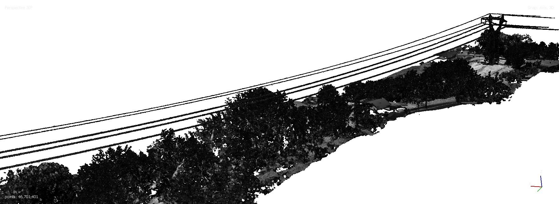
Thanks to state of the art LiDAR sensors, our drones are able to generate high-density point clouds with sub-centimetre accuracy in a matter of hours, while allowing to monitor the inspection progress with real-time previews of what we are surveying, in order to guarantee that 100% of the inspected asset has been reconstructed.
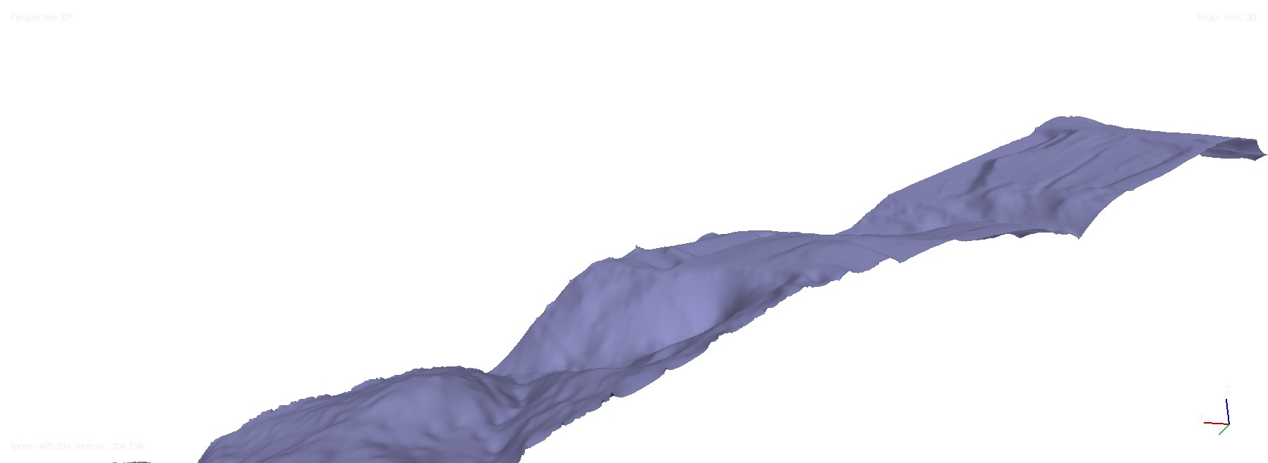
Point cloud to DTM
We can help you:
Trasmission line
Extensive land surveys and topographical surveys permit the most definite representation of cadastral maps, immediately and in a hassle-free manner.
Land management &
development
Our background in land management and development has supported several private and government agencies for secure pre-construction planning.
Bridge, Roads
and Highways
Drones are a popular and conventional method of Stockpile measurements in the industry.
Railways
The slope monitoring process through GIS mapping conducted by our experts successfully recognizes the steepness of the ground’s surface using the Digital Terrain Model (DTM) and Digital Surface Model (DSM).
City Mapping
With astonishing advancements in drone technology, the use of drones in urban planning has become extensive. Through drone surveying, we can accumulate enormous amounts of data quickly and at lower prices due to AI processing and machine learning.
Architecture
We help you to represent reality by providing you with As-Built maps to create or update safety plans.
Deliverables we provides:
- Classified Dense point cloud
- Digital Surface models (DSM)
- Digital Terrain Model (DTM)
- Contour Maps
- 3D Models
Range of industries
- Digital Twin Creation and Maintenance
- Corridor mapping
- Mining (volume calculation)
- Construction site monitoring
- Environmental changes (time series)
- Forestry
- Contour mapping
- Leveling/Excavation
- Archaeology and cultural heritage
- Highway construction
Our geospatial services includes data generation, manipulation, management, conversion, migration, and maintenance for GIS and other information management systems.
We answer the most common questions
In contrast to photogrammetric GSD, we use Density in Lidar Surveys to define the amount of data recorded.
Density is measured in points per square meter ( pts/mq ), higher values will lead to more detailed surveys, but will result in longer flights and heavier files.
The term Overlap indicates how much of a first scan is present in the next one, and it is expressed in %.
Having some data repeated in both scans allows us to merge multiple passes or flights with a high precision, avoiding misalignments.
The results of a photogrammetric survey (aerial or ground based) are limited by what the camera can see and distinguish cleary, so it is impossible to acquire something that is hidden (like the ground under the tree canopy) or reflective.
Lidar sensors are able to measure multiple echoes from a single laser beam, doing so, we are able to detect both the higher layer of leaves and the ground beneath, making generating true DTM possible even in areas covered by vegetation.
Lidar is also faster than photogrammetry.
Lidar data needs almost no post-processing, a first point cloud is ready in just minutes after the flight, meanwhile it can take hours to get a sparse cloud from images.